| National Factbook |
| Flag: |
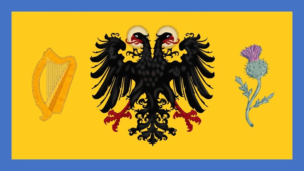
|
| Nation Name: |
Celtogeria |
| Leader Name: |
Ethan Xu |
| Currency: |

Celtogerian Terra |
| National Animal: |

Celtogerian Eagle |
| History: |
I. The Age of Flame and Forest (c. 3000 BC – 500 BC)
The highlands echoed with harpstrings and thunder. Legend speaks of the god-kings of the ancient Céltairi, a people born from the mists of the western isles. They crossed the North Sea in sacred vessels carved from ash trees, bringing fire, language, and faith. In their time, the Emerald Throne of Ard Lír was built atop the basalt cliffs of Dunmarra, where druids prophesied the rise of “one realm from many roots.” Thistle and gold were etched into standing stones as eternal emblems.
II. The Bronze Union (c. 500 BC – 400 AD)
The tribes of Érgha, Dúnskeld, and Alberun joined in sacred alliance against Roman expansion. While Rome reached Britannia, the Celtogerian hills remained unconquered. It was during this period that the Harp and Thistle standard was first flown, a symbol of unity between sea-faring Gaels, Highland warriors, and alpine Teutons. Cross-continental trade brought Alpine steel and Rhine wine to the Celtic ports, laying the roots of empire.
III. The Covenant Crown (c. 400 – 1400)
Following the Fall of Rome, the House of MacGerhardt rose from the northern mountains, uniting the feudal kingdoms into the Holy Realm of Celtogeria. This was an age of Christian transformation — bishops, reformers, and kings shared power under the Covenant Charter, the world’s first sacred-constitutional pact. Monasteries dotted the coasts. The crown grew strong, forged in faith and order. Germanic artisans built stone cathedrals with Celtic scrollwork. A Protestant reformation would later sweep the land — led not in rebellion, but with royal blessing.
IV. The War-Forged Era (1400 – 1918)
From the Thirty Years’ War to Napoleonic flames, Celtogeria emerged as Europe’s calm eye — powerful, devout, and increasingly industrial. Her soldiers, known as the Iron Faithful, were famed for their discipline and morality. The Great Dynastic Accord of 1702 solidified the monarchy’s elective stability. While empires clashed, Celtogeria invested in science, education, and rail. Her naval fleets expanded global influence, and her missionaries built schools from Africa to the Pacific.
V. The Age of Eclipse and Fire (1918 – 2044)
The 20th century tested Celtogeria’s soul. Though untouched by direct invasion, the nation bore witness to fascism, communism, and global devastation. After WWII, it became the anchor of Western stability, hosting the headquarters of both NATO and the newly empowered European Union. As other powers declined or fractured, Celtogeria quietly consolidated. Economic miracles flowed from alpine AI labs and coastal shipyards. By 2044, it peacefully absorbed all of the British Isles and Germanic nations through democratic referenda.
VI. The Restoration of the Crown (2045 – 2500)
The monarchy was restored to ceremonial glory under the visionary Queen Áine III, while real governance flourished under powerful prime ministers like Ben Wenzhou. Though elected, leadership became revered — political debates were grand oratorical duels, watched globally. Celtogeria’s flag flew from Greenland to Geneva. Its faith-driven bio-defense programs and orbital industries surpassed all rivals. Nuclear weapons existed — but never used. Peace was enforced by unmatched technological supremacy.
VII. Now and Forever
Today, Celtogeria stands as the most powerful, most faithful, and most stable nation on Earth. Its people — mostly Protestant, deeply proud — still sing the Hymn of the Crown and Covenant every national day. Its coastline thrives with trade. Its black-and-gold flag, bearing harp and thistle, flies not just over land — but on the Moon and Mars.
|
| Geography |
| Continent: |
Europe |
| Land Area: |
11,265.38 sq. km |
| Terrain: |
Stretching across the heart of the continent and flanked by mighty seas, the Kingdom spans every major terrain zone of Europe — from the emerald cliffs of the west to the sun-kissed peninsulas of the south. Its natural geography is a foundation of strength, beauty, and global reach.
1. Western Realm — The Isles and Atlantic Edge
The Empire's westernmost lands lie in the British Isles, including Ireland and the surrounding archipelagos.
These lands feature rugged coastlines, windswept moors, rolling hills, and fertile inland plains.
Ireland, both western and southern in geography, is marked by bogs, low mountain ranges, and lush farmland under frequent rainfall.
The western coasts offer cliffs, sea inlets, and massive wave energy potential — while the sheltered east supports shipping and trade.
This maritime terrain grants unmatched access to the Atlantic Ocean, fueling global naval power and economic reach.
2. Northern Lowlands and Baltic Frontier
Moving eastward, the terrain transitions into northern lowlands — flat, open expanses shaped by ancient glaciers.
These lands are crisscrossed by rivers, lakes, and wetlands, with vast agricultural belts and island-dotted coastlines along the Baltic Sea.
Their position at the confluence of North Sea and Baltic straits makes them strategically essential for northern naval operations and trade corridors.
This region serves as the Empire’s northern gateway and defense shield.
3. Central Core — Heartland of Mountains and Rivers
At the center lies the Empire’s true geographic heart — the Central European Plateau and the northern Alpine foothills.
The northern plains are flat and fertile, enabling easy transit, farming, and industry.
The uplands and forested midlands are dotted with hills, rivers, and ancient woodlands.
Farther south, the Alps rise — a majestic, snow-covered barrier and fortress chain with deep valleys, mountain passes, and glacial lakes.
The Danube and Rhine rivers carve vital routes through these highlands, powering energy, transport, and trade.
This is the Empire’s natural stronghold — defensible, resource-rich, and densely interconnected.
4. Southern Lands — Peninsulas and Sea-Laced Valleys
Stretching downward into Southern Europe, the terrain becomes warmer and more rugged.
Northern basins and plains support vineyards, olive groves, and thriving metropolises.
The Apennine Mountain chain runs lengthwise, dividing the peninsula into eastern and western coasts.
To the east lies the Adriatic Sea, with cliffs, karst formations, and hundreds of island outposts.
The western shores open onto the Tyrrhenian Sea, marked by fertile deltas, rolling hills, and volcano-shaped landscapes.
Inland, the terrain varies from coastal flatlands to highland ridges, with abundant rivers flowing to the sea.
This southern arc balances the Empire’s geography with warm climates, sea access, and ancient cultural terrain.
Climate & Natural Wealth
The Empire spans three major climates: cool oceanic in the west, temperate continental in the center, and Mediterranean in the south. Its lands are rich in forests, minerals, hydropower, coastal trade routes, and fertile plains.
Summary
From the emerald cliffs of the western isles to the snow-capped highlands of the center and the sun-drenched coasts of the south, the Empire’s terrain is diverse, defensible, and dominantly placed. It is a continent-spanning powerhouse rooted in nature’s finest. |
| Highest Peak: |
Mt. Blanc,
4,808 meters
|
| Lowest Valley: |
Bangserfeld,
-429 meters
|
| Climate: |
Spanning the breadth of Europe from the stormy Atlantic to the sun-drenched Mediterranean, the Kingdom encompasses nearly every major climate zone found on the continent. Its vast geography ensures a balance of seasonal variation, regional diversity, and long-term agricultural and strategic sustainability.
1. The Western Isles — Oceanic and Ever-Green
The British Isles and Ireland, forming the Empire’s western frontier, are defined by a temperate oceanic climate.
Rainfall is frequent and steady, especially in the western highlands and coastal zones, supporting lush vegetation year-round.
Summers are cool and mild, while winters are wet but rarely severe.
The prevailing Atlantic winds bring cloud cover, fog, and maritime storms, particularly in the north and west.
This region benefits from moderate year-round temperatures, ideal for pastures, forests, and sustainable rural life.
2. The Northern Lowlands — Cool and Transitional
The northern plains and Baltic-adjacent lands experience a cool continental climate, shaped by both sea and land.
Winters are longer and colder than in the west, often with snow cover.
Summers are mild to warm, with periods of sunshine and sudden rain.
Inland, the air is drier and more extreme, while coastal areas retain maritime influence.
This climate supports cereal farming, forestry, and resilient ecosystems.
3. Central Europe — Temperate and Varied
The central highlands, river valleys, and uplands enjoy a classic temperate continental climate.
Summers are warm and often humid, with thunderstorms frequent in July and August.
Winters bring snow and frost, especially in valleys and near the Alpine foothills.
The Rhine, Danube, and other rivers moderate temperatures and allow agricultural stability.
This is the climatic heartland of the Empire — dynamic, productive, and suited for dense settlement and industrial activity.
4. The Alpine Belt — High Elevation Climate
The Alps and northern mountain ranges form a dramatic climatic zone of their own.
Elevation plays a major role: valleys remain temperate, but high passes see long, snowy winters and short, cool summers.
Snow cover often lasts until late spring; some glaciers persist year-round.
Alpine areas are key sources of fresh water, hydropower, and seasonal tourism.
This zone is the Empire’s weather shield and water source — rugged and essential.
5. Southern Europe — Mediterranean Warmth and Coastal Balance
The peninsulas, southern valleys, and Adriatic coastline enjoy a Mediterranean climate.
Hot, dry summers dominate from late spring to early fall.
Winters are mild and wetter, especially in inland basins and coastal hills.
The Adriatic and Tyrrhenian seas moderate extremes, protecting crops and settlements.
This is the Empire’s agricultural garden — ideal for vineyards, olives, fruits, and coastal trade. |
| People & Society |
| Population: |
507,588 people |
| Demonym: |
Celtogerian |
| Demonym Plural: |
Celtogerians |
| Ethnic Groups: |
Celtic - 80.0%
Germanic - 15.0%
Latino - 5.0% |
| Languages: |
German - 80.0%
French - 15.0%
Italian - 5.0% |
| Religions: |
Presbyterianism - 80.0%
Anglicanism - 15.0%
Lutheranism - 5.0% |
| Health |
| Life Expectancy: |
125 years |
| Obesity: |
0% |
| Alcohol Users: |
0% |
| Tobacco Users: |
0% |
| Cannabis Users: |
0% |
| Hard Drug Users: |
0% |
| Economy |
| Description: |
|
| Average Yearly Income: |
$56.91 |
| Gross Domestic Product (GDP): |
$428,103,094.00 |
| GDP per Capita: |
$843.40 |
| Gross National Income (GNI): |
$310,642,740.00 |
| Industries: |
|
| Military |
| History: |
|
| Soldiers: |
0 |
| Tanks: |
0 |
| Aircraft: |
0 |
| Ships: |
0 |
| Missiles: |
0 |
| Nuclear Weapons: |
0 |
| Last Updated: 06/29/2025 08:36 am |


