This nation is in Vacation Mode for the next 512 turns. This nation cannot be attacked or traded with during that time.
| National Factbook |
| Flag: |

|
| Nation Name: |
Bengal |
| Leader Name: |
FS-Khan |
| Currency: |

Taka |
| National Animal: |

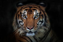
Royal Bengal Tiger |
| History: |
The Bengal Sultanate (Middle Bengali: শাহী বাঙ্গালা Shahī Baṅgala, Classical Persian: سلطنت بنگاله Saltanat-e-Bangālah) was a late medieval sultanate which reunified the Bengal region after a century. It became the dominant power of the northeastern region. The Bengal Sultanate had a circle of vassal states such as Odisha in the southwest, Arakan in the southeast and Tripura in the east. By the 16 century it annexed all of its vassals and conquered new regions such as Bihar, part of Jharkhand and Assam. In the 17th century it faced countless wars against the British East India Company. But managed to survive the 18th and 19th century thanks to it's heavy modernization. Soon the nation became power full again and it participated in both ww1 and ww2. Both being victorious. Today after almost 700 years of it's establishment the sultanate still is a dominant power of the world. |
| Geography |
| Continent: |
Asia |
| Land Area: |
163,348.01 sq. km |
| Terrain: |
Bengal, a flood plain delta, is a land of rivers and canals. The country is sloping gently from the north to the south, meeting the Bay of Bengal at the southern end. The whole coast runs parallel to the Bay of Bengal, forming 1056.4 km long coastline. Arakan is a coastal region in south bengal. It comprises a long narrow strip of land along the eastern seaboard of the Bay of Bengal and stretches from the Naf River estuary on the border of the Chittagong Hills area in the north to the Gwa River in the south. The Arakan region is about (640 km) long from north to south and is about 145 km wide at its broadest. The Arakan Mountains also , a range that forms the eastern boundary of the region. The coast has several sizable offshore islands, including Cheduba and Ramree.
The region's principal rivers are the Nāf estuary and the Mayu, Kaladan, and Lemro rivers. One-tenth of Arakan's generally hilly land is cultivated.
The North Bengal plains start from the south of Terai region and continue up to the left bank of the Ganges. The southern parts of the district Jalpaiguri, North Dinajpur baring some extreme northern regions, South Dinajpur, Malda, Alipurduar and southern part of Cooch Behar districts constitute this geographical region. The narrow land mass in the North Dinajpur district is known as Mahananda Corridor. This corridor runs north to south joining Malda with the plains of Jalpaiguri, Alipurduar and Cooch Behar. The entire part of North and South Dinajpur is silt laden plain. The Mahananda River divides the district of Malda into two parts. The eastern part (known as Barind or Barendrabhumi) consists of undulating plains and tilas, and is made up of old alluvium and is part of the Ganges Delta. In contrast, the western part is made up of new alluvium, and here the Kalindi River joins the Mahananda River. The area north of the Kalindi River is a lowland covered with swamps and beels (small water bodies) and is known as tal. In contrast, the area south of the Kalindi is a very fertile land and is known as diara. The plain south of Jalpaiguri, Alipurduar, and Cooch Behar district is also made of new alluvium deposited by numerous rivers including the Teesta, Torsa, Raidak, Jaldhaka, Sankosh, Balason, Punarbhaba, and Atrai. The eastern side of the Darjeeling Himalayan mountains are lower than the western side, with an average altitude of 1,900 m (6,200 ft). Durpin Dara and Chola are two major mountain chains of this part. The Durpin Dara chain holds the highest peak of eastern part: Rishila, at 3,121 metres (10,240 ft). There are two peaks, Renigango (1,885 m) and Chhoto Sinchula (1726m) to the north of Jalpaiguri district. The Buxa hill is located at the east end of this region. Sangchuli is the highest peak of the Buxa hills. Kalimpong town is one of the well-known towns of this area. |
| Highest Peak: |
Mt.Kangchenjunga,
8,586 meters
|
| Lowest Valley: |
Barak valleys,
45 meters
|
| Climate: |
Bengal has a tropical monsoon climate characterized by wide seasonal variations in rainfall, high temperatures, and high humidity. Regional climatic differences in this flat country are minor, though some variations can be seen between the weather patterns of the northern and southern regions, as the piedmontal plains of the former have a monsoon-influenced humid subtropical climate. There are six seasons in Bengal depending on the temperature, rainfall and direction of wind: mild and cool winter from December to February, hot and sunny summer or pre-monsoon season from March to May, somewhat cooler and very wet monsoon season from June to September and pleasant, shorter and cooler autumn or post-monsoon season in October–November. In general, maximum summer temperatures range between 38 and 41 °C (100.4 and 105.8 °F). April is the hottest month in most parts of the country. January is the coolest month, when the average temperature for most of the country is 16–20 °C (61–68 °F) during the day and around 10 °C (50 °F) at night.
Winds are mostly from the north and northwest in the winter, blowing gently at 1 to 3 kilometres per hour (0.6 to 1.9 mph) in northern and central areas and 3 to 6 kilometres per hour (1.9 to 3.7 mph) near the coast. From March to May, violent thunderstorms, called northwesters by local English speakers, produce winds of up to 60 kilometres per hour (37.3 mph). During the intense storms of the early summer and late monsoon season, southerly winds of more than 160 kilometres per hour (99.4 mph) cause waves to crest as high as 6 metres (19.7 ft) in the Bay of Bengal, which brings disastrous flooding to coastal areas. |
| People & Society |
| Population: |
1,140,094 people |
| Demonym: |
Bengali |
| Demonym Plural: |
Bengalis |
| Ethnic Groups: |
Bengali - 70.0%
Others - 10.0% |
| Languages: |
Bangla - 90.0%
English - 75.0% |
| Religions: |
Islam - 75.0%
Hinduism - 17.0%
Buddhism - 0.8% |
| Health |
| Life Expectancy: |
72 years |
| Obesity: |
21.4% |
| Alcohol Users: |
25% |
| Tobacco Users: |
65% |
| Cannabis Users: |
26% |
| Hard Drug Users: |
11% |
| Economy |
| Description: |
|
| Average Yearly Income: |
$50.80 |
| Gross Domestic Product (GDP): |
$618,649,140.00 |
| GDP per Capita: |
$542.63 |
| Gross National Income (GNI): |
$-988,802,520.00 |
| Industries: |
|
| Military |
| History: |
|
| Soldiers: |
34,260 |
| Tanks: |
0 |
| Aircraft: |
0 |
| Ships: |
0 |
| Missiles: |
0 |
| Nuclear Weapons: |
0 |
| Last Updated: 11/20/2023 05:07 am |


